
TopCop GIS
High availability mapping and analysis
Visualize the "where", then drill-down to understand the "what"
TopCop GIS brings a visual, geospatial view to use-of-force, pursuit, canine utilization and other location-based critical incidents collected by BlueTeam and IAPro.
Using TopCop GIS, IAPro and BlueTeam customers will be able to make more informed evidence-based decisions, target resources, and formulate strategies.
Front-line supervisory and command staff can use TopCop GIS to inform tactical analysis and decisions.
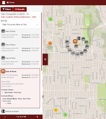
Drill-down to review critical incidents
TopCop GIS offers interactive capabilities including drill-down, zoom and other map features. These allow users to "dig in" to their data from a high level, so they can more fully understand critical incident occurrences in their jurisdiction.
Real-time filtering and redaction
TopCop incorporates real-time filtering and redaction frameworks already developed for EIPro.
Like EIPro, TopCop provides a platform that ensures users are able to only view data that system administration have provided them access to.
"Heat-map" mode
The interface can be switch to view data in "heat map" mode with one click.
Underpinned by enterprise technologies
TopCop is built using the latest, most advanced enterprise level technology platforms. TopCop is engineered with Java back-end fronted by a modern user interface (UI) built using the latest Javacript frameworks.
TopCop is designed to be run using any of the major browsers.
Proximity search
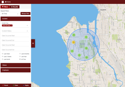
Proximity search capabilities enable users to identify critical incidents occurring in specific areas and communities.
Ad-hoc search
A wide range of search capabilities are available
Filtered real-time
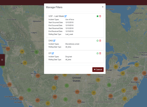
Information filters can be configured so that TopCop will display the incidents that are of interest